What are the best program to create 3d maps online or on a computer? List 2021
With the great transformation of the digital world and the remarkable capabilities of web browsers, today, users have access to an unlimited amount of information, as well as numerous platforms and applications that are helpful for different actions. Which, simplifies people’s tasks effectively.
In that sense, nowadays, it is even possible to “visit” or see up close any place in the world, even if you leave your home. This, through certain programs or online solutions from which people can make 3D maps on a specific area that, previously, has been defined in the platform in question.
Therefore, if you want to plan routes using 3D maps , have a guide based on a specific area in the world or even measure the duration of your next trips; you need to know how you can create these types of maps from your computer . Therefore, below, we will introduce you to several suitable softwares and other online alternatives.
What are the minimum requirements that my computer must have to work with 3D maps?
Although it is true, 3D maps or three-dimensional maps are defined as those elements that provide a more realistic, concise and detailed visualization of a certain area. In this way, they are characterized by allowing the discovery of new perspectives that, in most cases, cannot be observed in a two-dimensional or traditional way.
Now, for a computer to allow working with 3D maps from programs or applications, it must have certain peculiarities to be able to support them or, otherwise, it will not support said visualization in any way.
As a consequence, it is appropriate to know what the minimum requirements are to be able to create 3D maps from your computer and, then, we mention them:
- A RAM memory of 32 or 64 GB. Since, it is the one that is needed to use the various data hosted on the computer. Therefore, the more RAM memory the machine has, the greater the flow of information can be accessed simultaneously.
- A powerful CPU processor and a good number of cores. As this can guarantee a constant high load over time and the more cores a computer has, the higher the speed of its CPU. Thus, the processing and rendering of the maps can be streamlined.
- An optimal graphics card. This element is essential to ensure an excellent display of the 3D map on the screen. Therefore, it will be relevant to see the results in the best possible way.
List of the best programs for 3D map modeling on Windows and MacOS
Having mentioned the basic requirements of a computer to accept the modeling of three-dimensional maps, it is appropriate to proceed to name which are the recommended programs to create this type of graphic elements directly from a Windows or MacOS computer.
Next, we proceed to point one by one:
DungeonMapDoodler.com
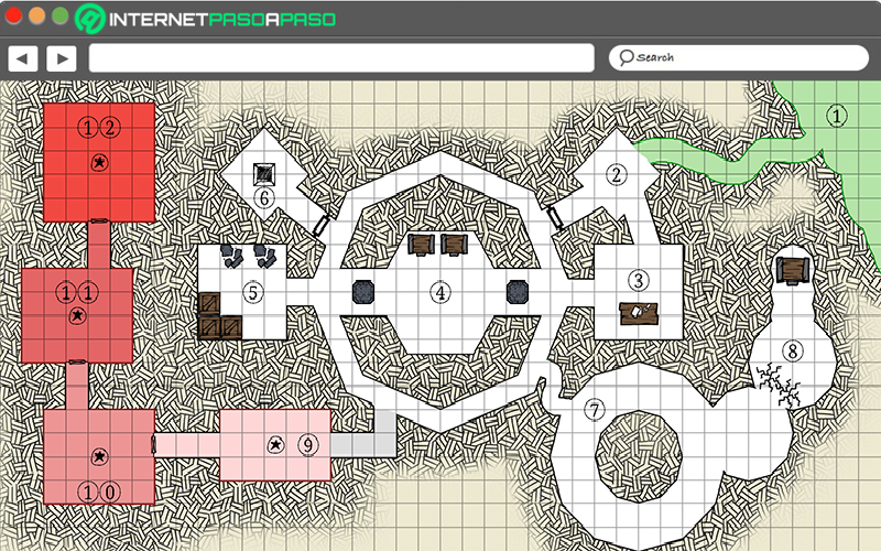
This consists of an innovative drawing tool that is completely free and offers the possibility of creating maps in just minutes. Thus, it refers to a program used to produce the characteristic 3D maps of many tabletop role-playing games.
Among its main peculiarities, we find that, Dungeon Map Doodler provides a PNG export functionality so that you can save your creation as an image on your computer, either to use in any other software you need or to print it. In addition to that, you can easily draw grids, place different objects (doors, tables, stairs, etc.) and add your own stamps.
Photoshop
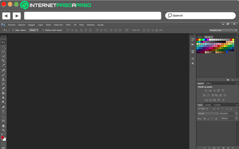
Although, mainly, this renowned program is used as a photo editor to retouch images and graphics, the truth is that it also works as an excellent tool for creating 3D maps. Since, thanks to its powerful utilities, it offers the ability to produce high-quality 3D objects and animations.
In this sense, all those advanced users who know how to handle Photoshop correctly for this, will be able to benefit from its intuitive interface when creating 3D maps. This, from the use of 2D layers as a starting point, in order to create a series of 3D objects, move them in 3D space, change the rendering settings and even combine them with other 3D layers.
Download Photoshop Windows
Qgis
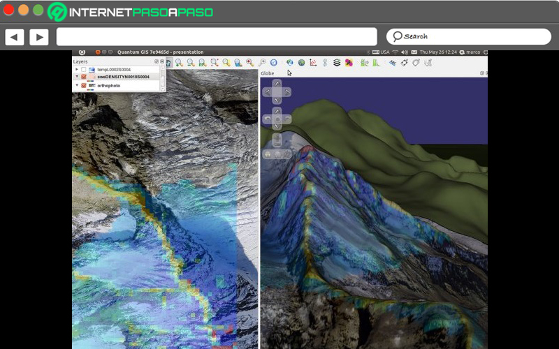
It is a program available for Windows and MacOS that can be downloaded and installed for free to create well developed three-dimensional maps. One of its greatest advantages is that it offers the possibility of inserting a lot of information and even customizing it, depending on the user’s requirements.
Download Qgis Windows
Download Qgis MacOS
Microsoft Excel
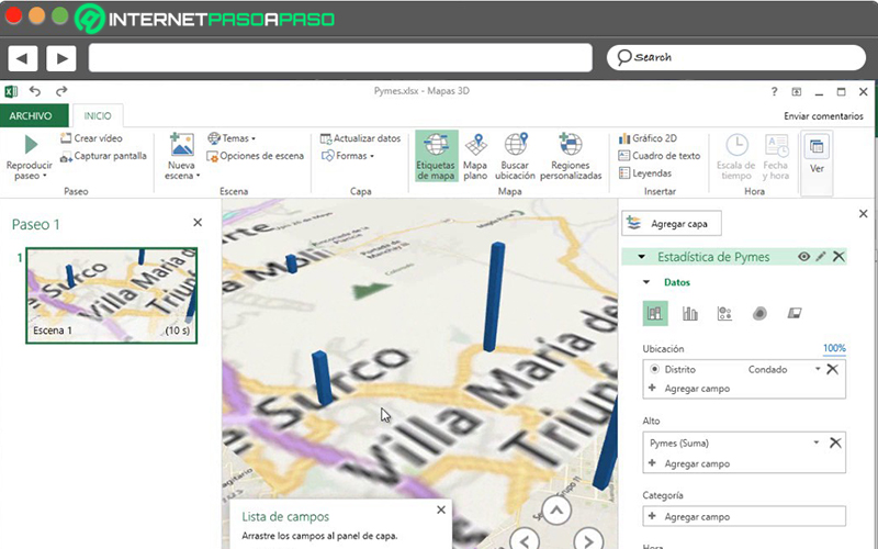
From this tool belonging to the Microsoft office suite, there is the possibility of creating and using 3D maps in order to explore data with any type of map to customize them. Either to show routes or verify certain distances.
But, to be able to do them, it will be necessary to have an image of a floor plan or a route map (in JPG, PNG or BMP format). In addition to this, Excel also requires certain data selected with the image so that the 3D maps can be drawn by means of an XY coordinate system.
With this, to create your custom map, you will simply have to carry out the following procedure:
- Open the Microsoft program and access the book that contains the data for the XY coordinates of the images.
- Now, proceed to select the “Insert” tab and click on 3D Map. To do so, choose the option “New route”.
- Next, in 3D maps, you have to click on “Start” and “New scene”.
- After that, choose “New custom map” and through the Customize maps options box, click on “Browse for the background image”.
- Later, you have to find and select the image you prefer to use.
- Then, as necessary, proceed to adjust the X and Y coordinates. Also, you can flip the axes, auto-adjust, and lock the current coordinate values.
- Finally, click “Apply” and, in the Layers panel , choose Next. That way, you will have already created your 3D map in Microsoft Excel.
MagicaVoxel
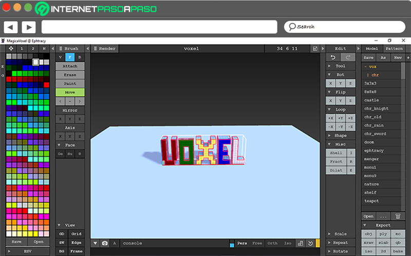
Available for Windows and Mac, it refers to a free program that does not require many resources and offers the possibility of creating 3D elements and exporting them to other modeling programs to continue working. Therefore, it supports an export process in OBJ, PLY and PNG formats .
In addition to this, with MagicaVoxel you have the possibility of adding different effects, such as: reflections, smoothing and modifying the background color. In addition to this, the program offers many more options with the aim that each user can personalize their experience to the maximum, directly from their computer. It is useful, as long as the person has some advanced knowledge.
Download MagicaVoxel Windows
Download MagicaVoxel MacOS
Wings 3D
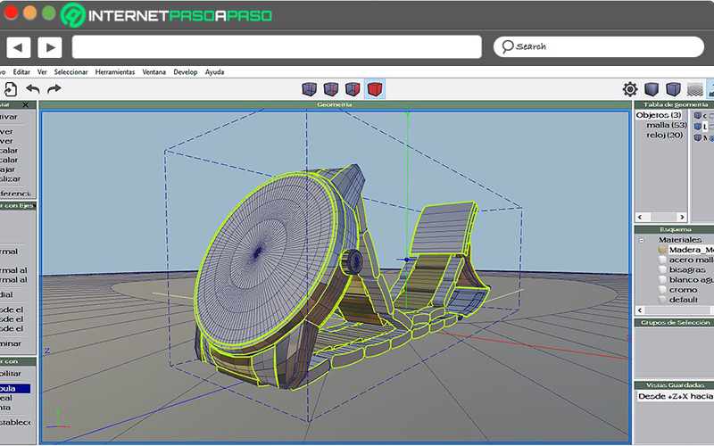
For free, this 3D modeling software is also considered a good alternative for creating 3D maps. Thus, it consists of a utility compatible with Windows and Mac that has been designed to model and texture elements formed with a smaller number of polygons.
As for the graphical user interface, we highlight that it provides considerable flexibility based on different limitations provided by other programs of this type. So, for example, it offers easy handling and a very intuitive icon system to streamline creation processes. It can even be merged with other programs to make high-quality images.
Download Wings 3D Windows
Download Wings 3D MacOS
Learn about the best online tools to create 3D maps without installing any software
Beyond the programs for Windows and Mac available to model maps in 3D, there are several solutions on the Internet with which it is possible to create personalized maps without the need to install any software and some do not even require prior registration.
Therefore, below, we present 5 solutions that you can try, online:
Maps3d.io
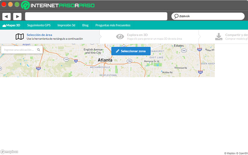
Through this tool, users have the power to generate their own personalized maps in just seconds. Since, you simply have to enter the web application through your Internet browser of preference and from there, you will have access to a general map based on the whole world in which you can freely move and zoom.
Now, to be able to find the exact area where you want to locate yourself, you will only have to click with the mouse and drag the pointer towards that area. Even making use of the dialog box located in the upper left corner, the tool allows you to enter the specific city to start creating the three-dimensional map.
Later, when you indicate the chosen area, you have to click on “Explore in 3D” in order to generate the map in question. In this way, in a few seconds, it will be displayed on the screen and it only remains to zoom on it or add a GPS route with the help of another tool, to manage it depending on your needs.
EzMap.co
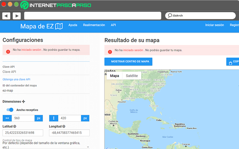
Basically, it refers to a Google Maps tool ideal for creating maps and embedding them on any website. In that sense, to obtain their personalized map, users only need to select a specific region on the map and add markers or controls to manage them online .
Despite the fact that, generally, it does not require prior registration, those who wish to save their maps on the computer will have to register on a mandatory basis. On the other hand, Ezmap.co allows you to make use of a wide variety of themes available based on Snazzy Maps, it has different options to adjust the experience according to your requirements and it even provides you with an exclusive code for your elaborated map.
InstaMaps.cat
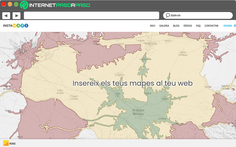
It consists of a free- to- use web platform that, without the need to be an advanced user, allows its visitors to both analyze and edit, as well as visualize geographic data in order to create and share maps online, in a very easy way. Regarding its main features, we highlight that it has the ability to create 3D views with WebGL technology and allows to organize collaborative maps (10 users maximum).
Additionally, it has a responsive design to be able to handle the web application both from the computer and also through mobile devices. Likewise, it allows you to export and import data in different reference systems and various formats, offers the possibility of choosing different base maps, as well as applying numerous styles to the data, and has no limitations in terms of maps and layers.
OpenStreetMap.org
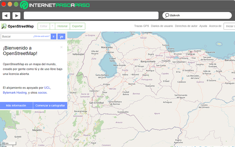
It is defined as a web tool that is based on virtual 3D plans that, today, define urban planning and architecture in a different way than the satellite map. In this way, it is classified as a new project that, online, allows you to create editable and free maps.
Thus, mainly, through OpenStreetMap, people will be able to obtain views of all those buildings that are vectorized and in that way, they will be able to observe different shadows cast during the day or depending on the current situation of the user. Like, elements in movement and maps with relief of the surface of the terrain.
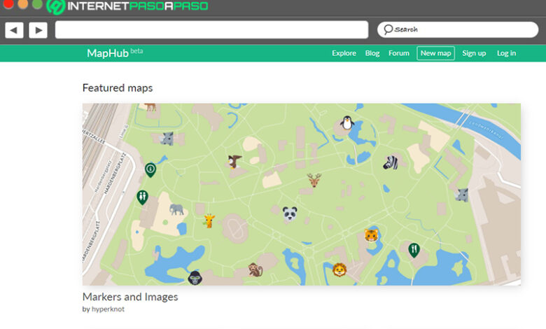
MapHub.net
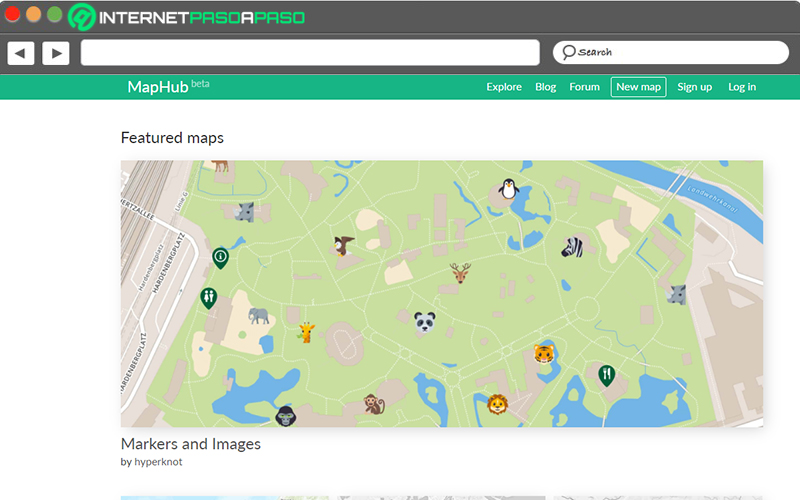
This is a free and online tool that stands out for its modern interface through which it offers the possibility of creating personalized maps, in a simple way. Since, you will have the option to choose between a total of 20 base maps for it and in this way, it will speed up the development process.
For its part, it is characterized by being a tool that has the ability to export and import the data used, in different formats (KML, GPX or GeoJSON). Added to that, it also allows you to add markers, labels, lines or polygons, as well as control who can see your creation and edit it. Additionally, it provides a URL for each map, in order to support its distribution via email or social networks.
If you have any questions, leave them in the comments, we will answer you as soon as possible, and it will surely be of great help to more members of the community. Thanks!